UNDERMINING RIGHTS

Indigenous Lands and Mining in the Amazon

Partners:

Background

The Amazon is covered with large-scale mining concessions with many overlapping with indigenous lands. Many other indigenous lands are indirectly affected by mining, from infrastructure, new towns for workers, and other associated developments. Artisanal and small-scale gold mining also takes place throughout the Amazon. Today, more than 500,000 small-scale gold miners are estimated to be active in the Amazon. Due partly to rising gold prices, illegal mining has grown exponentially in recent years.

The Amazon river basin covers roughly 40 percent of South America8 and includes parts of eight countries: Bolivia, Brazil, Colombia, Ecuador, Guyana, Peru, Suriname, and Venezuela, as well as French Guiana, a department of France (Table 2.1). The Amazon biogeographic region—the area where the animals and plants have similar or shared characteristics—is larger than the river basin.9 The biogeographic region is a mosaic of ecosystems, including rainforests, seasonal forests, deciduous forests, flooded forests, and savannas. The forests, covering just over 80 percent of the biogeographic region, constitute the world’s largest tropical forest and over half of the planet’s remaining rainforests. About 60 percent of the Amazon basin and forest lies in Brazil (NASA 2018; Butler 2019a; RAISG 2019a).

The Amazon forest provides a range of ecosystem services that are crucial to local populations and society at large, including climate and water flow regulation, water cycle mediation, pollination and food provision, nutrient retention, pest control, protection from storms and floods, and soil erosion prevention. The forest accounts for about 10 percent of the world’s terrestrial primary productivity and harbors about 10 percent of the world’s biodiversity.10 It absorbs 2.2 billion tonnes of carbon dioxide (CO2) a year and stores about 10 percent of the world’s carbon (about 1.1 × 1,011 metric tonnes of carbon), critical for climate change mitigation (Tian et al. 2000; Saatchi et al. 2007; Field Museum 2013; McDonald 2019).11 The river system produces about 20 percent of the world’s freshwater discharge (Davidson et al. 2012).12 More than 600 protected areas safeguard 1,984,569 sq. km or 23.4 percent of the Amazon (RAISG 2019a).

The Amazon has been settled by humans for at least 11,200 years, although some estimates put the first human settlements in the Amazon at 32,000 to 39,000 years ago (Roosevelt et al. 1996; WWF 2020). Today, the region is home to 44.9 million people (Table 2.1), including about 1.5 million indigenous peoples from 385 different ethnic groups (RAISG 2019a) as well as many Afro-descendants13 and other traditional people. In 2010, when Brazil conducted its last census, about 517,000 of the country’s 897,000 indigenous peoples lived in the country’s formally recognized indigenous territories (IBGE 2010). More than 100 tribes live with little or no contact with the outside world.

Excluding Suriname, indigenous peoples hold about 2,369,000 sq. km of land, about 28 percent of the Amazon basin (RAISG 2019a) (Table 2.1). Almost 80 percent of the indigenous lands (1,871,000 sq. km) in the Amazon is legally recognized as such under national laws. The indigenous lands in Suriname have not been mapped with any great precision (and no indigenous lands are titled) but is estimated to cover 106,160 sq. km, about 65 percent of the country (ACT 2020). Including this land, indigenous lands total about 2,475,000 sq. km, more than 29 percent of the Amazon basin. Almost half (47 percent) of the indigenous lands in the Amazon (1,157,000 sq. km) is in Brazil. About 70 percent of the Amazon in Suriname and Venezuela is indigenous lands and more than 50 percent of the Amazon in Colombia and Ecuador are indigenous lands.

Table 2.1 | Amazon Countries by the Numbers

Country

Amazon area of country (sq km)

% of total area of country

% of total area of the Amazon Basin

Amazon population of country

% of total population of country

% of total population of the Amazon Basin

Indigenous Land in the Amazon—formally recognized & not recognized (sq km)*

% of the country's Amazon

% of the total area of the Amazon Basin

Bolivia

714,834

65.1

8.4

6,572,024

65.5

14.6%

187,431

26.2%

2.2

Brazil

5,239,647

61.5

61.9

28,266,715

13.6

63.0%

1,156,900

22.1%

13.7

Colombia

506,145

44.3

6.0

1,411,079

2.9

3.1%

269,763

53.3%

3.2

Ecuador

132,292

53.2

1.6

870,000

5.1

1.9%

67,326

50.9%

0.8

French Guiana

84,226

100.0

1.0

208,171

100.0

0.5%

7,068

8.4%

0.1

Guyana

214,969

100.0

2.5

751,000

100.0

1.7%

31,671

14.7%

0.4

Peru

966,190

75.2

11.4

4,076,404

13.0

9.1%

322,255

33.4%

3.8

Suriname

146,523

100.0

1.7

492,829

100.0

1.1%

106,160

72.5%

1.3

Venezuela

470,220

51.3

5.5

2,231,932

7.0

5.0%

326,521

69.4%

3.9

TOTAL

8,475,046


100.0

44,880,154


100.00%

2,475,095


29.2

Sources: Data from RAISG 2019a and ACT 2020, modified by WRI authors

Forest Cover

In the early 2000s, after many years of high forest loss, annual deforestation rates in the Amazon declined.14 The drop was largely due to a nearly 80 percent reduction in the annual deforestation rate in Brazil from 2004 to 201215 (Fearnside 2017; Mongabay 2018; Turubanova et al. 2018; INPE 2020; GFW 2020a). The government increased law enforcement, expanded protected areas, recognized indigenous territories, and applied a suite of carrots and sticks to rein in uncontrolled conversion to agriculture, even while increasing cattle and soybean production (Nepstad et al. 2014; Seymour 2018). Still, from 2010 to 2017, Brazil accounted for 76 percent of deforestation in the Amazon (Butler 2019b; GFW 2020a).

In recent years, however, deforestation rates have again risen, especially in Brazil (GFW 2020a; INPE 2020) (Figure 2.1). This is partly due to the economic downturn in Latin America, which has led many governments to focus on economic growth sometimes at the expense of environmental protection. In 2016, 2017, and 2019, forest fires in the Amazon resulted in a significant uptick in tree cover loss. In 2019, for example, Bolivia experienced record-breaking tree cover loss, 80 percent greater than the next highest year on record, due to fires in both primary forests and in surrounding woodlands (nearly 12 percent of the Chiquitano dry forest in eastern Bolivia was burned) (GFW 2020b; Weisse and Goldman 2020).

Figure 2.1 | Annual Forest Cover Loss in the Amazon


Source: Based on data from GFW 2020a, modified by WRI authors.

In Brazil, the government is rolling back policies that reduced deforestation rates earlier this century (Box 2.1).16 According to Brazil’s National Institute for Space Research (Instituto Nacional de Pesquisas Espaciais, INPE), 4,232 sq. km of forest cover was lost from August 2018 to July 2019. That represents a 74 percent increase from the same period a year before (INPE 2020; Londoño and Casado 2020). In 2019, Brazil accounted for over a third of global primary forest loss (GFW 2020b; Weisse and Goldman 2020).

In Colombia, nearly 4,250 sq. km of forest was lost in 2017, a 46 percent jump from 2016, and more than double the average rate of loss between 2001 and 2015 (Jong 2018; GFW 2020a). The loss of forests in Colombia may be linked to the peace agreement with the Revolutionary Armed Forces of Colombia (Fuerzas Armadas Revolucionarias de Colombia, FARC), the country’s largest rebel group (Box 2.2).17 A recent study focusing on the Andes-Amazon Transition Belt (AATB) found that during the post–peace agreement period (2017 to 2018), the area of forest disturbance increased by 50 percent (about 238,000 ha) across the AATB in comparison with the four-year peace negotiation stage (2013 to 2016). Forest disturbance also spread deeper into the Amazon watershed and increased in area by 187 percent within the AATB’s protected areas (Murillo-Sandoval et al. 2020). With new protection measures, however, Colombia experienced a significant decrease in primary forest loss in 2019 (a 35 percent drop from 2018), the first decline since the rapid increase in loss after the 2016 peace agreement (GFW 2020b; Weisse and Goldman 2020).

box 2.1 | New Policies in Brazil

Since January 2019, the new government in Brazil has made a number of changes to key environmental and indigenous people agencies. It has cut the budgets and staff of Brazil’s principal environmental agencies, including the Ministry of the Environment—the Brazilian Institute of Environment and Renewable Natural Resources (Instituto Brasileiro do Meio Ambiente e dos Recursos Naturais Renováveis, IBAMA, responsible for environmental protection) and the Chico Mendes Institute for Biodiversity Conservation (Instituto Chico Mendes de Conservação da Biodiversidade, ICMBio, responsible for managing federal conservation areas). Enforcement measures such as fines, warnings, and the seizure or destruction of illegal equipment have been pulled back, which has hampered efforts to fight illegal mining, logging, and ranching.

These changes have corresponded to a significant uptick in land grabbing, illegal activities, fires, and deforestation in the Brazilian Amazon.a The destruction of the forest on indigenous land has also increased dramatically. In 2019, deforestation reached 115 indigenous lands with 42,679 ha destroyed between August 2018 and July 2019, an increase of 80 percent compared to the previous year (ISA 2019). In response, the governments of Germany (US$39 million) and Norway ($33.27 million) have suspended their donations. The Amazon Fund is a REDD+ mechanism to prevent, monitor, and combat deforestation, as well as to promote preservation and sustainable use in the Brazilian Amazon. Norway, the Amazon Fund’s largest donor, has given about $1.2 billion over the past decade.b

The new administration has also cut the budget and staff of the National Indian Foundation (Fundação Nacional do Índio, FUNAI), the government agency responsible for establishing and implementing policies related to indigenous peoples.c In addition, there have been several (unsuccessful) attempts to transfer FUNAI from the Ministry of Justice to the much weaker Ministry of the Family, and to hand the responsibility of demarcating indigenous land to the Ministry of Agriculture. The changes by the government have emboldened land grabbers and triggered a sharp rise in incursions into indigenous land, which has catalyzed and intensified rural confrontations.d Indigenous people defending their land have been targeted, threatened, intimidated, and murdered.e In 2019, of the 27 people who died from rural land conflicts, 7 were indigenous leaders, compared to two indigenous leaders in 2018. This is the highest toll in at least 11 years.f

Notes:

aBoffey 2019; Branford and Borges 2019; Ferrante and Fearnside 2019; Piotrowski 2019

bBoffey 2019

cPeriodista 2019; Branford 2019a

dBranford 2019a; Londoño and Casado 2020

eBBC 2019; Branford 2019a; HRW 2019

fFigueiredo 2019

Since the 1970s, more than 1.4 million ha of the Amazon forest have been cleared. Overall, an estimated 15–17 percent of the original Amazon forest has now been cut down and the land converted to other uses, with some experts putting the figure at 20 percent (Sonter et al. 2017; Piotrowski 2019; Viscidi and Ortiz 2019). The Amazon forest generates about half of its own rainfall by recycling moisture. Experts believe that if 20–25 percent of the forest is lost (from the 1970s total), the moisture cycle will be reduced to a point where the basin will no longer support rainforest (Piotrowski 2019; Viscidi and Ortiz 2019).18

In the last few decades, the pace of change in the Amazon has accelerated. With surging global demand for commodities such as beef, soybeans, sugar, and palm oil, Amazonian governments have scaled up private sector finance and increased infrastructure spending, including on roads, railways, and dams (Branford and Torres 2018b; Butler 2019b). Today, large quantities of Amazonian commodities are exported to China, Europe, the United States, and other countries.

Land uses that replace forests in the Amazon vary by country, and there is often a chain of events rather than a single cause, such as when mining roads give farmers and ranchers access to previously inaccessible forest areas. Cattle ranching is the leading land use replacing forests in the Amazon, accounting for 65–70 percent of the forest loss (UCS 2016; Curtis et al. 2018; Piotrowski 2019; Viscidi and Ortiz 2019).19 Agriculture, including subsistence, small-scale, and commercial farming, principally for soybeans but also rice, corn, and sugarcane, accounts for 25–30 percent of the land use change. Selective logging commonly results in degradation, not forest loss, although logging accounts for 2–3 percent of forest loss.20 Deforestation is exacerbated by climate change, which accelerates the spread of fires and pests (Piotrowski 2019; Viscidi and Ortiz 2019).

box 2.2 | Peace and Deforestation in Colombia

In Colombia, the 2016 peace agreement has opened up land, including indigenous land in the Amazon, to multinational interests such as mining and oil and mega-dam construction. This area was previously controlled by the Revolutionary Armed Forces of Colombia (Fuerzas Armadas Revolucionarias de Colombia, FARC), the country’s largest rebel group, which had imposed limits on mining, logging, and other development. The demobilization of the FARC left behind a power vacuum. Other armed groups, including criminal gangs, have moved in, leading to a spike in land grabbing and deforestation from unregulated agriculture, mining, and logging, and to an uptick in land conflicts and assassinations. Absent the threat of the FARC, land values have skyrocketed by as much as 300 percent in San Vicente del Caguán since the peace deal was signed. The capital infusion has helped improve the economy, which is based primarily on cattle ranching for milk and cheese production, but has also created a booming speculative market that rewards land grabbing. Colonizers are also displacing indigenous groups from their ancestral land.

Source: Volckhausen 2019.

Mining in the Amazon

Mining in the Amazon is dominated by industrial mining in the east, although mining for copper and gold is expanding into the forest (D.H. Bebbington et al. 2018a, 2018b) (Figure 2.2).21 Brazil is the fifth largest mineral producer in the world with about 8,400 mines in operation. Iron ore is Brazil’s leading mineral export and China its biggest market. China also finances much of the expansion of mining22 and related investments in hydropower and transportation. Vale S.A., Brazil’s mining giant, operates mines across the Amazon (D.H. Bebbington et al. 2018a, 2018b).

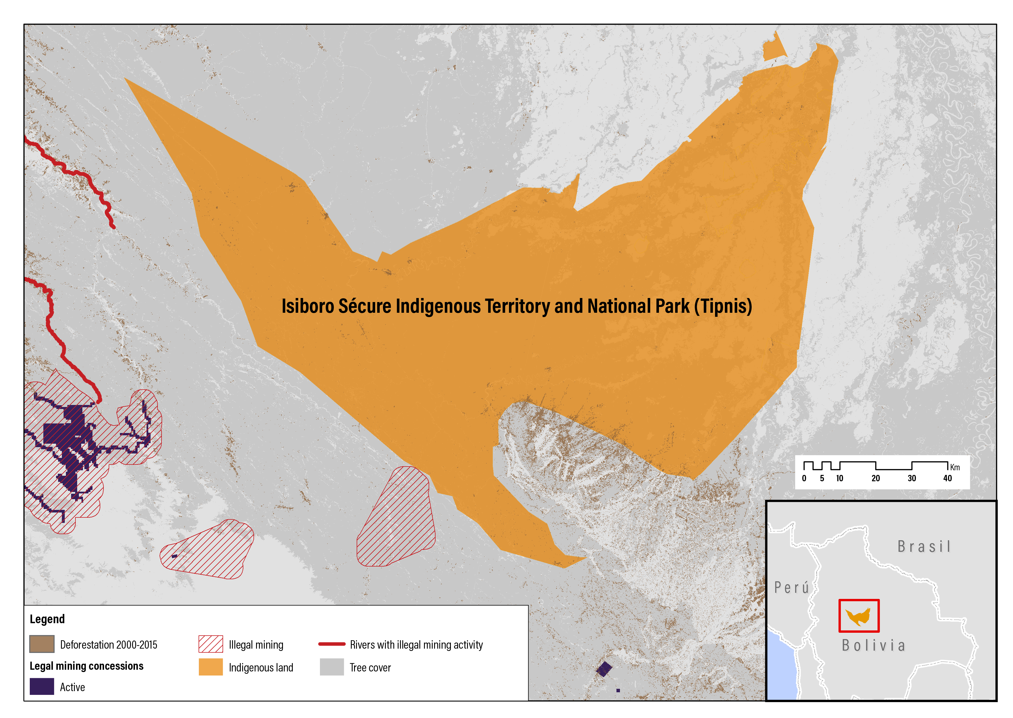
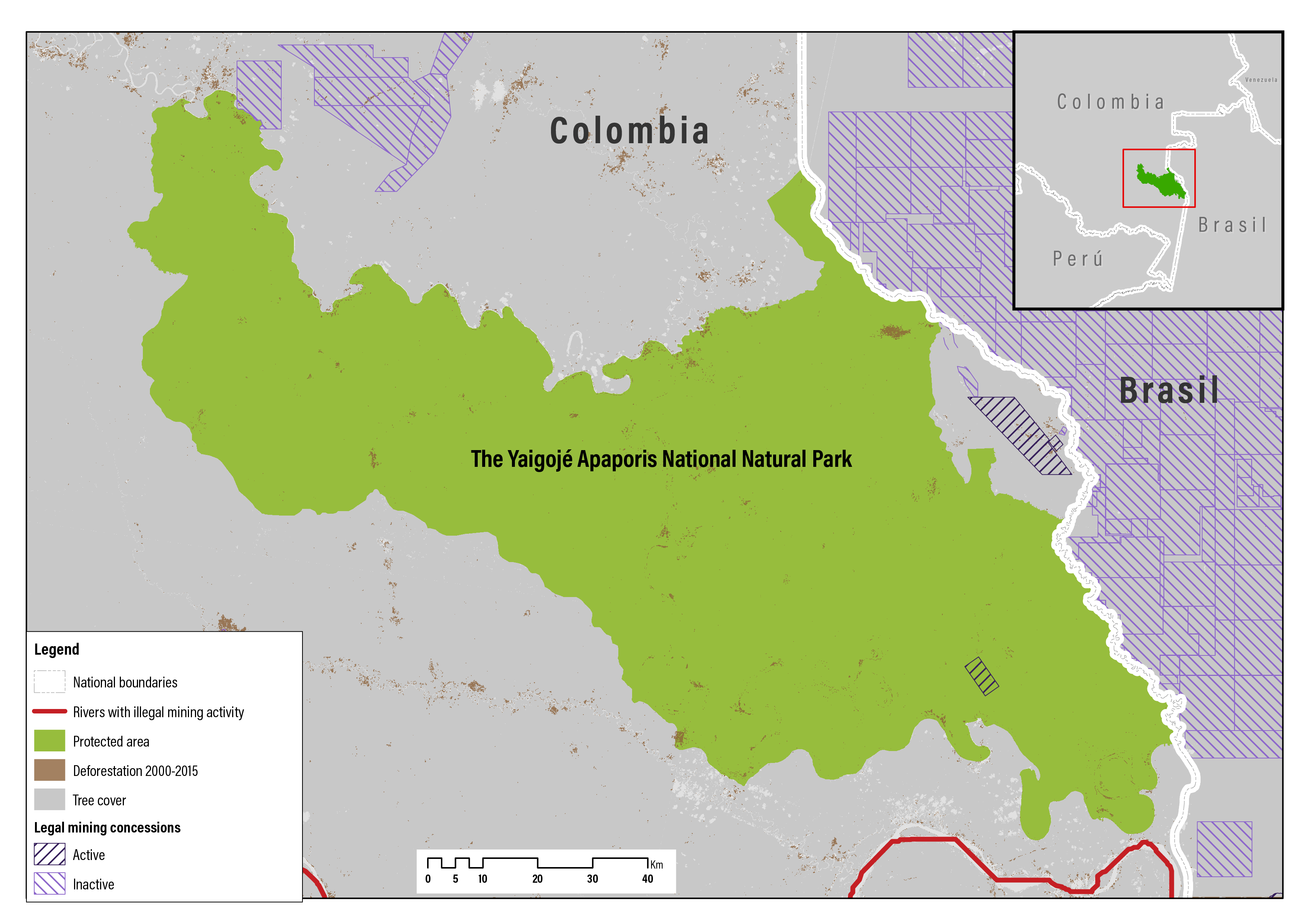
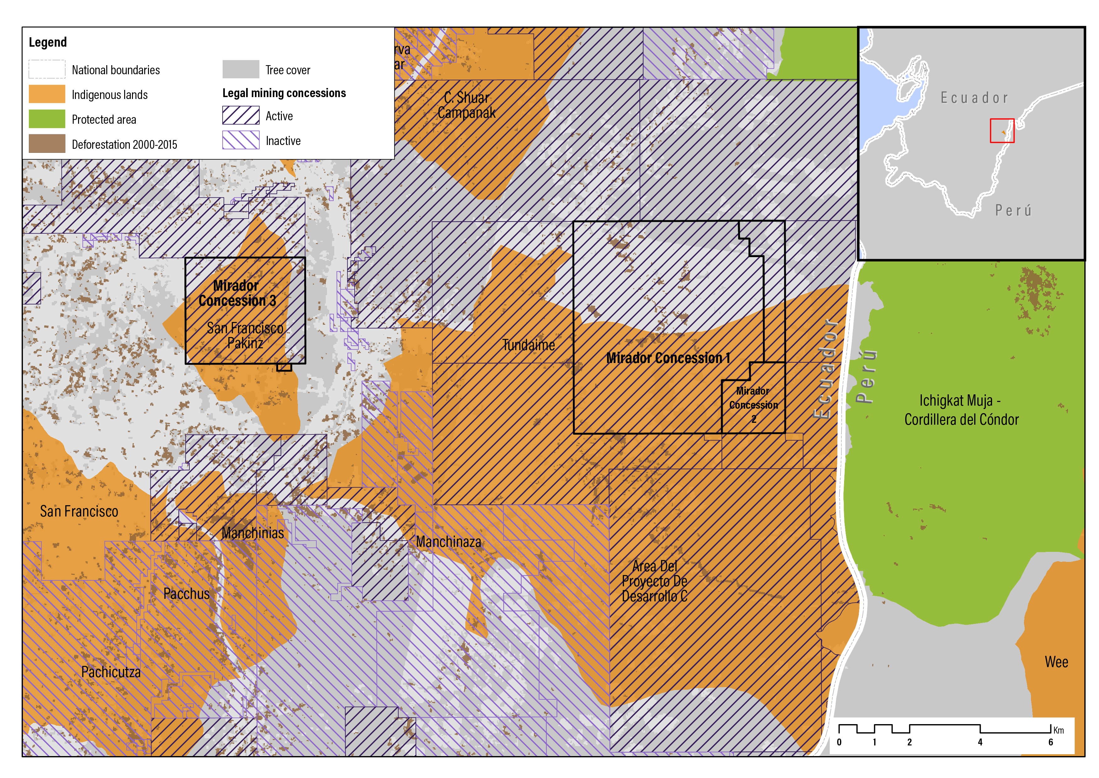
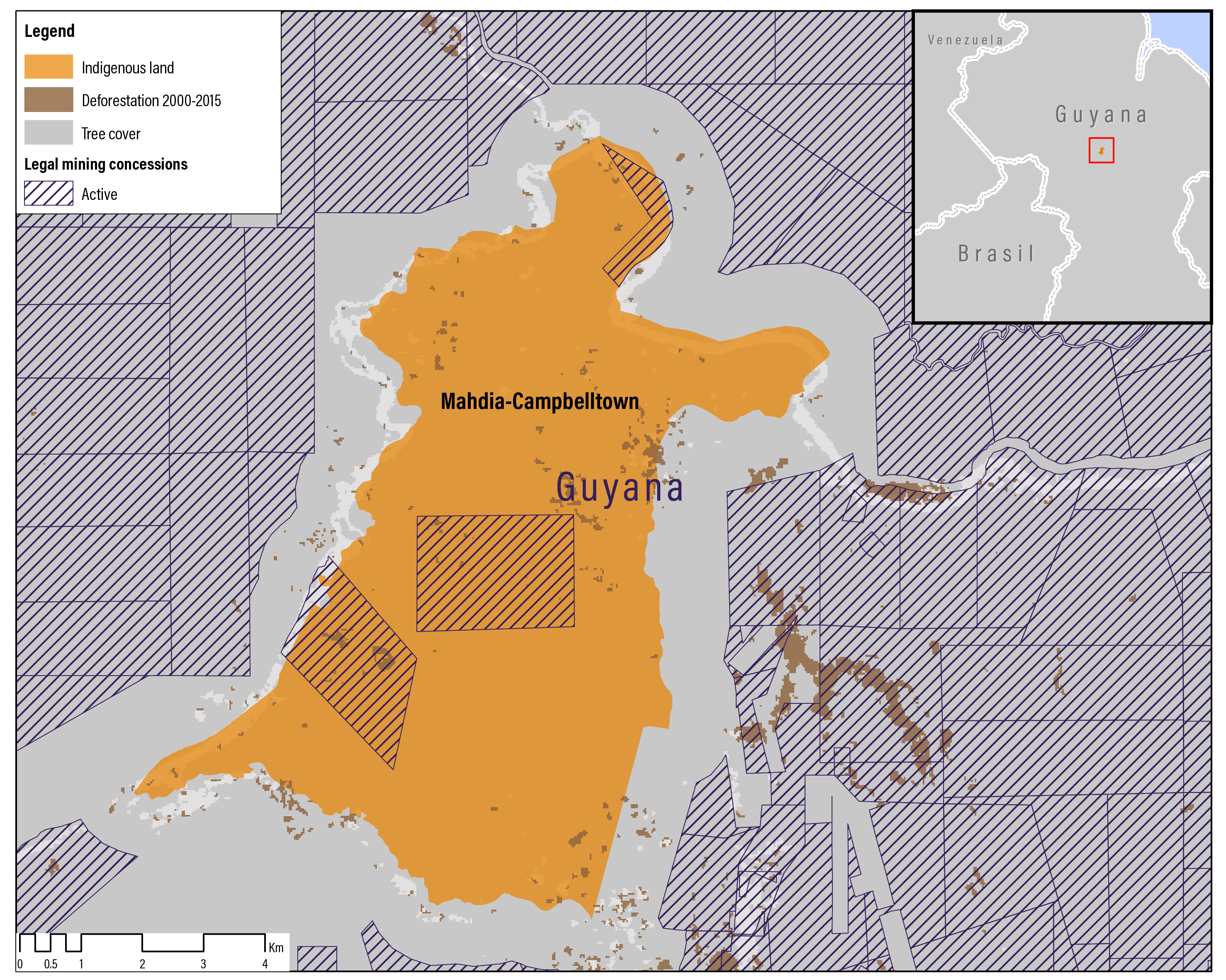
Large-scale mining blocks or concessions overlap with many indigenous lands and many other indigenous lands, are indirectly affected by mining, from infrastructure (e.g., roads, rail lines, and dams), new towns for workers, and other associated developments. While all concessions that overlap with indigenous lands in Brazil are, in the absence of an enabling law, legally suspended or canceled (but see below), many of the overlapping concessions in the other Amazonian countries are either under exploration or exploitation.

Figure 2.2 | Large-Scale Mining Concessions and Illegal Mining in the Amazon Region


Sources: Data from RAISG 2018c, 2018d and Guyana Geology and Mines Commission 2016, modified by WRI and RAISG authors.

In addition to industrial mining, ASM, especially for gold, takes place throughout the Amazon. ASM is defined as: “formal or informal mining operations with predominantly simplified forms of exploration, extraction, processing and transportation” (OECD 2016). Not all minerals are easily extracted by ASM. As such, ASM is often focused on a smaller set of minerals (e.g., gold and diamonds) than industrial mining. Hot spots of ASM for gold in the Amazon include the Guiana Shield, southern Peruvian Amazon,23 northern Brazil, and the Colombian Amazon (Alvarez-Berríos and Aide 2015). In these hot spots, ASM is the principal driver of forest loss.

Today, more than 500,000 small-scale gold miners are estimated to be active in the Amazon (Table 2.2), and many more people provide ASM services or are dependent family members of the miners (D.H. Bebbington et al. 2018a, 2018b). The expansion of ASM has been driven largely by rising gold prices coupled with limited livelihood opportunities (D.H. Bebbington et al. 2018a, 2018b).

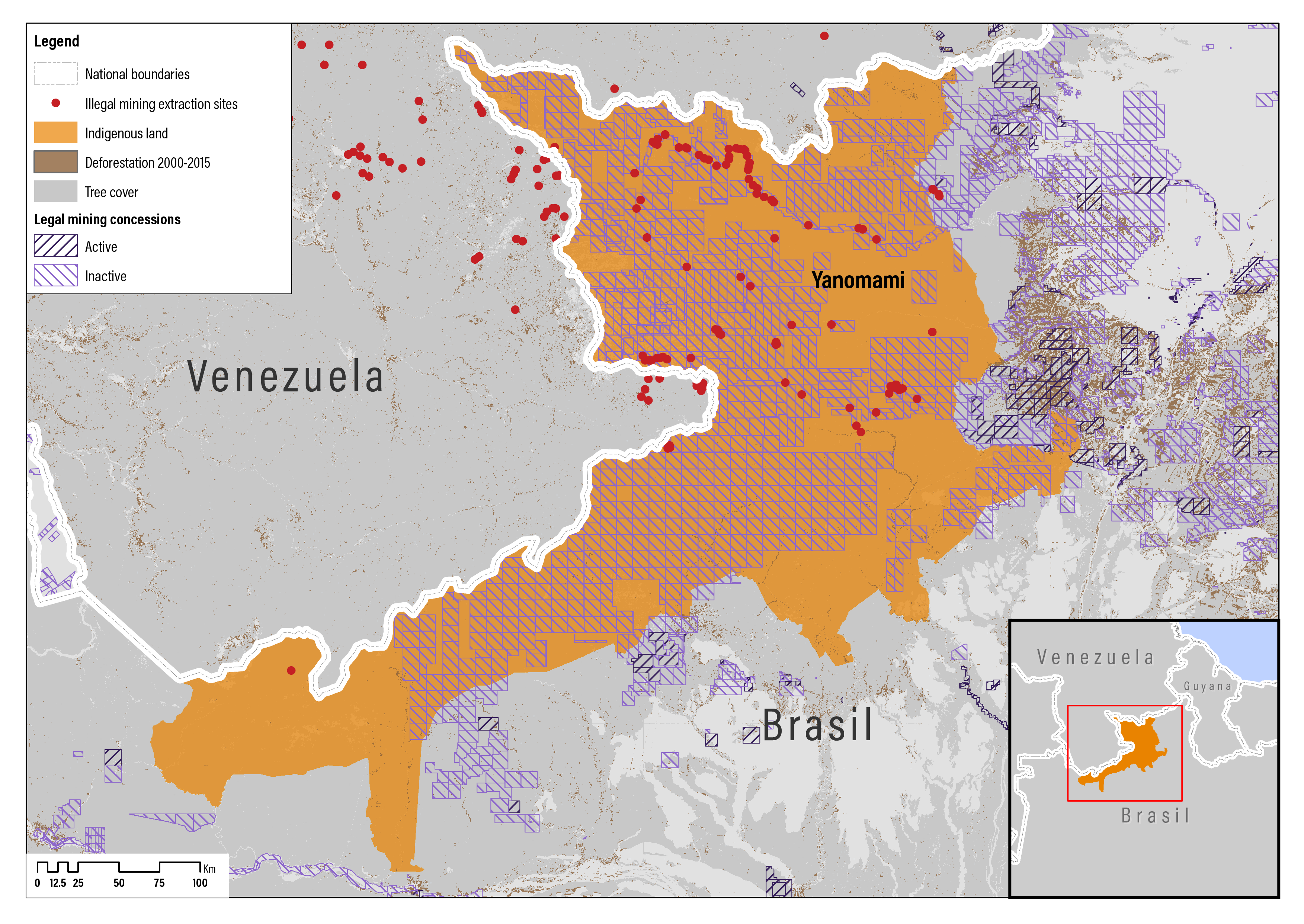
Most ASM for gold in the Amazon is alluvial mining—the mining of stream or riverbed deposits for minerals—with some degree of mechanization and collective organization. ASM is commonly low capital intensive, labor intensive, largely informal, and often operates outside the law and beyond government control (D.H. Bebbington et al. 2018a, 2018b). But the operations can be large and sophisticated, such as the illegal gold miners (garimpeiros) in the Yanomami indigenous lands in northern Brazil who are supplied by entrepreneurs with dredges, earthmoving equipment, and airplanes (see Case Studies; Branford 2019b).

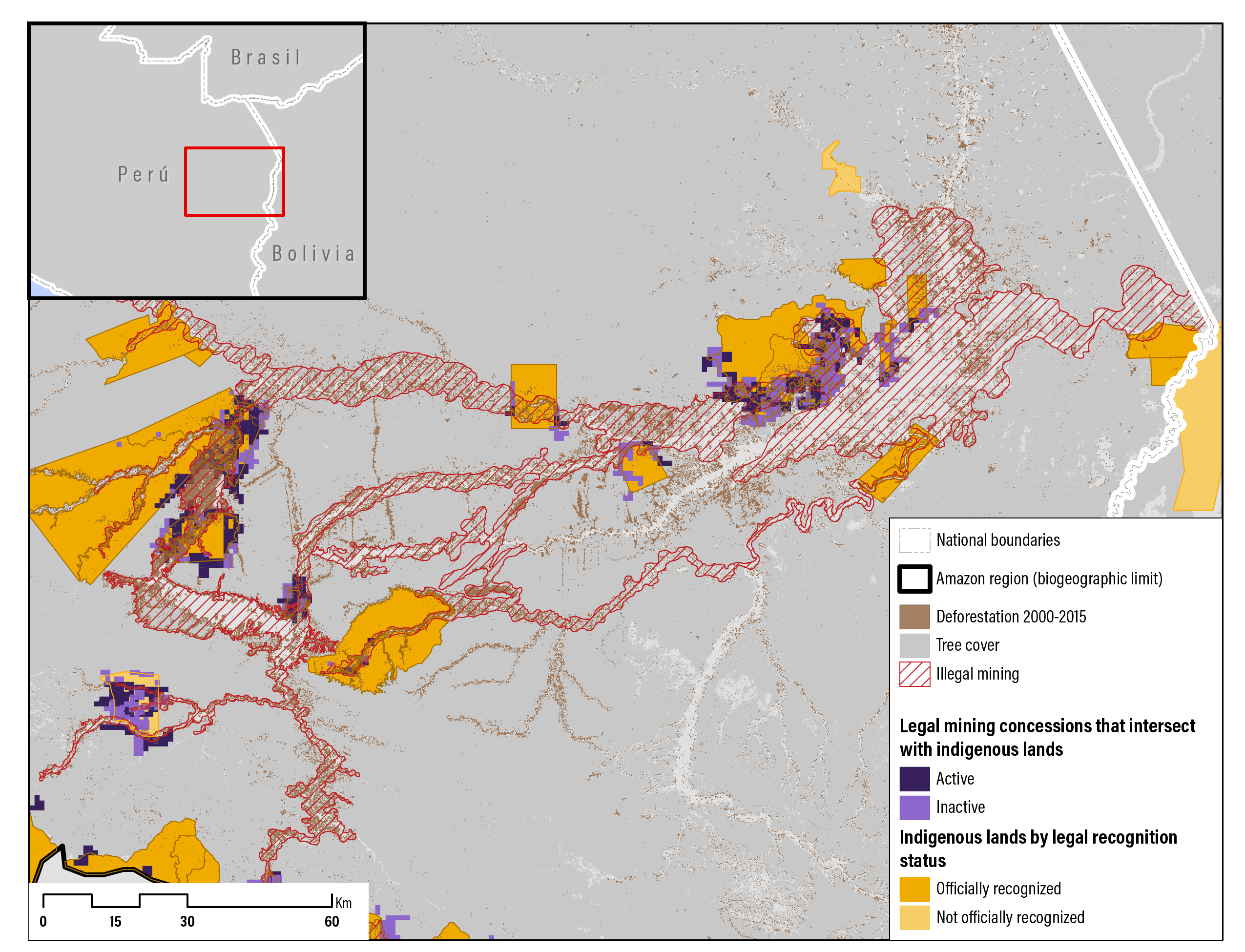
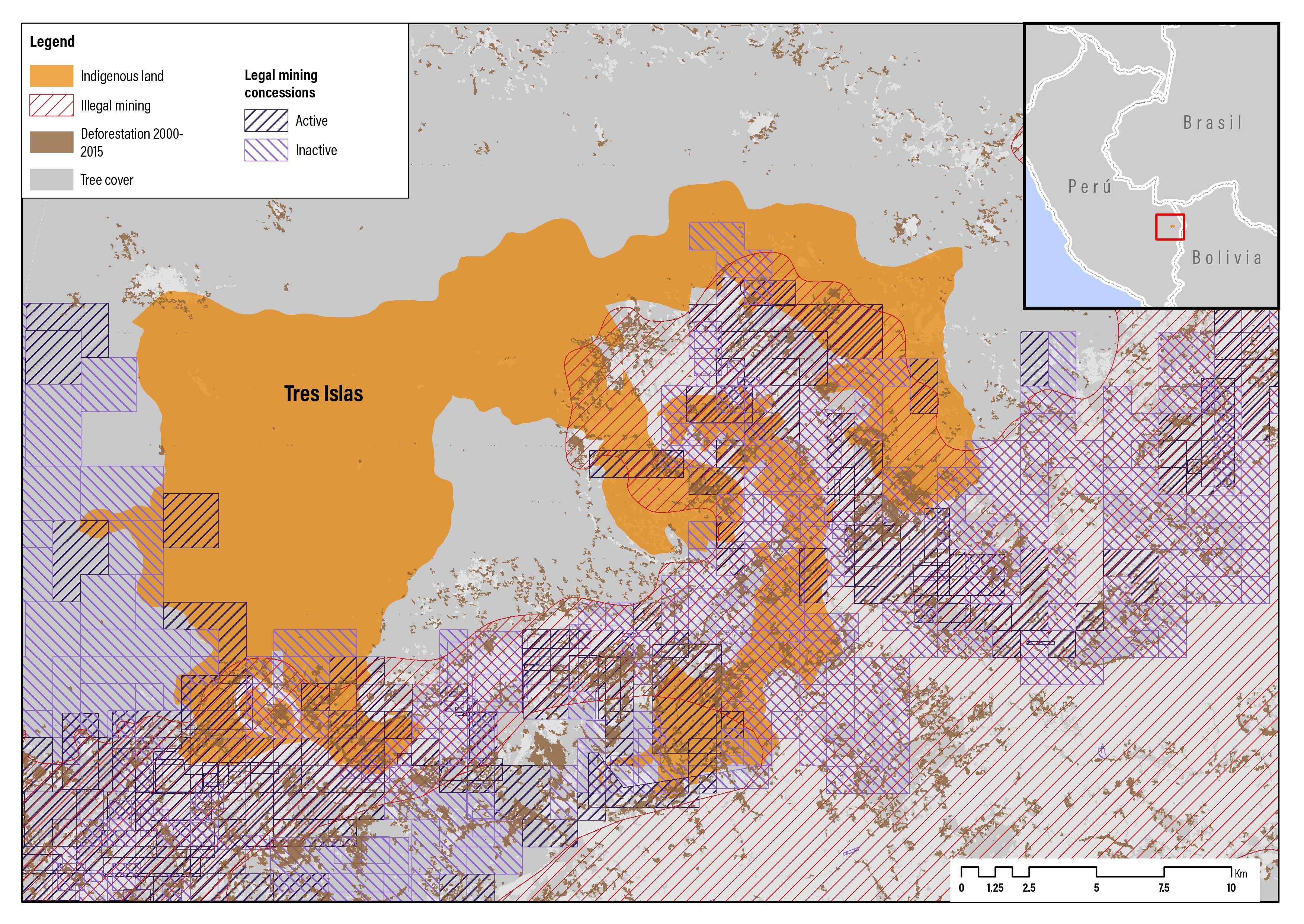
Illegal mining in the Amazon, principally ASM, has been underway for decades but has grown exponentially in recent years (RAISG 2018a). Illegal mining includes miners operating without legal mineral rights as well as miners or mining companies with legal mineral rights but with operations that are not in compliance with all relevant laws or contracts. For the purpose of this research, illegal mining is limited to miners operating without legal mineral rights. Illegal mining areas often overlap with large-scale mining areas, including on indigenous territories (Brown 2018a; RAISG 2018a), but it is also prevalent in protected areas (Wagner 2016). Despite government operations aimed at cracking down (Box 2.3), efforts to stop illegal mining have largely been unsuccessful.

Table 2.2 | Estimated Number of Small-Scale Gold Miners by Country and Areas Impacted

Country

# of small-scale gold miners

Amazon areas impacted

Brazil

200,000

States of Acre, Pará (Tapajós River) Rondônia (Madeira River) & Roraima

Bolivia

100,000

Departments of Beni, Pando, (Norte) La Paz, (Norte) Santa Cruz

Colombia

182,000

Border area with Venezuela and Brazil

Ecuador

90,000

Province of Zamora-Chinchipe

Peru

60,000

Departments of Madre de Dios, Amazonas, Huánuco

Venezuela

n/a

States of Amazonas and Bolívar

Source: D.H. Bebbington et al. 2018a.

There is a link between illegal gold mining and organized crime. The ongoing war on drugs coupled with the rising price of gold has encouraged organized criminal groups to engage in gold mining. Gold is also an easy way to launder drug money. Illegal gold mining in the Amazon is commonly undertaken by poor individuals (many from Andean regions) as a poverty reduction strategy. These miners are vulnerable to labor exploitation and human trafficking by organized crime mafias and cartels. That such mining is fragmented and hidden from the law has facilitated the entry of criminal organizations. It has proved so successful in Peru and Colombia that the value of illegal gold exports now exceeds the value of cocaine exports (Wagner 2016). Perhaps 90 percent of the gold mining in the Madre de Dios region of southeastern Peru, bordering Brazil, is illegal and run by organized crime and “the logging mafia” (Wagner 2016; Glenn 2019; Cimons 2019; Lombrana et al. 2019; Pacatte 2019).

In 2016, it was estimated that about 28 percent of gold mined in Peru, 30 percent in Bolivia, 77 percent in Ecuador, 80 percent in Colombia, and 80–90 percent in Venezuela was produced illegally (Wagner 2016). In 2018, RAISG identified 2,312 specific sites and 245 larger areas of illegal prospecting or extraction of minerals such as gold, diamonds, and coltan in six Amazonian countries—Bolivia, Brazil, Colombia, Ecuador, Peru, and Venezuela (RAISG 2018a). Most of the illegal mining activities were in Venezuela. Illegal mining was underway in 37 indigenous territories (including 18 in Brazil) and was operating on the border of and threatened another 78 indigenous territories (including 64 in Peru). Illegal dredging of rivers was underway within or on the border of 65 indigenous territories, including 30 in Colombia. In another 90 indigenous territories, illegal mining operations had occurred but were no longer active (RAISG 2018a).

box 2.3 | Illegal Gold Mining in Peru

Despite years of police and military operations, strict mining laws, and attempts to formalize the industry, illegal gold mining in the Peruvian Amazon is at record levels. The Department of Madre de Dios in the southeast is home to the large and rapidly expanding “La Pampa” illegal gold mine. From 1999 to 2012, the extent of gold mining in the region increased 400 percent.a

Today, this region has the highest forest loss and degradation caused by gold mining in the Amazon.b Between 2009 and 2017, deforestation caused by illegal gold mining increased by 240 percent.c Between 1985 and 2017, 95,750 ha were deforested by gold mining, mostly illegal, in Madre de Dios. Much of the recent gold mining deforestation is concentrated in reforestation areas and the buffer zones of the Tambopata National Reserve and Bahuaja Sonene National Park. It is also occurring near or in several indigenous territories, including the Amarakaeri Communal Reserve and the Kotsimba Native Community.d

In 2018, deforestation from illegal gold mining reached a record 9,280 ha, leading the government to declare a state of emergency in the Madre de Dios region in February 2019.e The government sent 1,500 police and military officers to the region in an effort to stop illegal mining. Illegal gold mining, however, continues to disrupt indigenous people and their lands.

Notes:

aAsner et al. 2013

bRAISG 2018a

cCINCIA 2018

dFiner and Mamani 2018

eNeal and Roberts 2018; RAISG 2018a; Viscidi and Ortiz 2019

Start reading