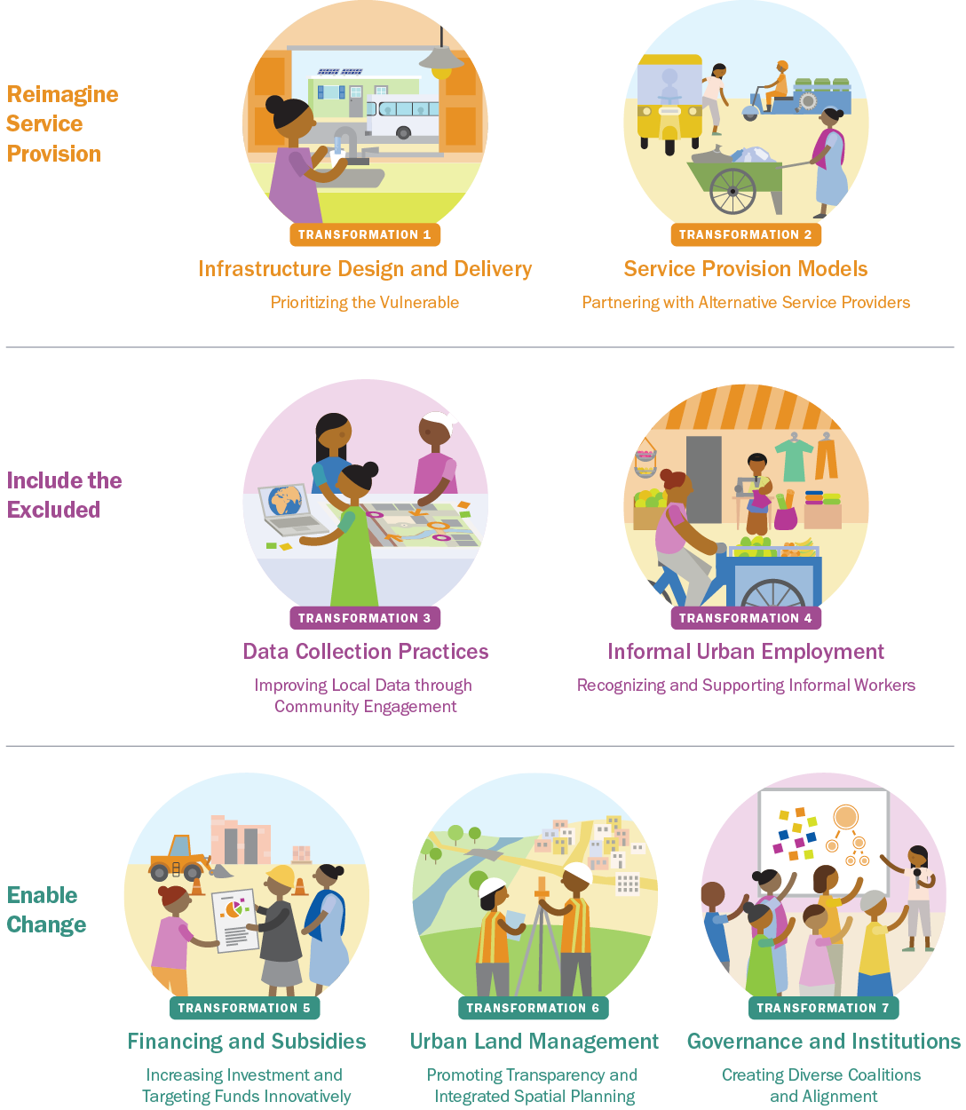
Seven Transformations for More Equitable and Sustainable Cities

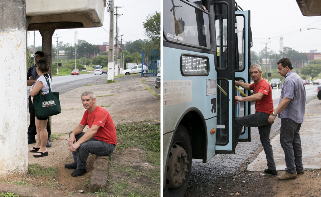
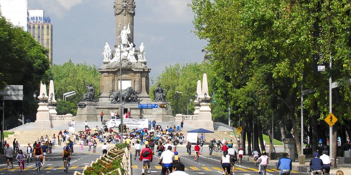
Image: EMBARQ Brasil

Image: EMBARQ Brasil

World Resources Report

Chapter 11

Urban Land Management – Promoting Transparency and Integrated Spatial Planning

Transparent, well-regulated land markets and effective integrated spatial planning are absolutely central for delivering services equitably and ensuring the long-term future of the city. In rapidly growing cities, the scarcity of well-serviced land and weak planning have exacerbated spatial inequities. Through better regulations, innovative incentives, provision of secure tenure, and integrated planning, many cities have made land markets more transparent and inclusive and have enabled equitable service provision.
 

11.1 What Must Change and Why

Urban land markets have a sordid underbelly

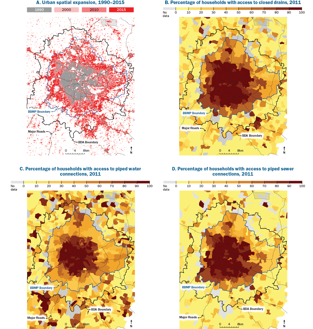
Cities across the world struggle with corruption and rapacious behavior in land markets because land is such a valuable asset. Land markets in many cities of the global South are opaque and distorted. The reasons include poor records of landownership, lack of transparency on property transactions, complex land titling regulations, and excessive land value speculation.403 Nonexistent or ineffective land regulations mean public sector stakeholders cannot prioritize the public’s interests, make crucial decisions about what gets built where, harness the benefits of increasing land values, or use this asset to generate the municipal revenue needed to invest in services and infrastructure.404 These challenges are magnified where city officials either have no development plan or have no power to implement or enforce one. They may lack the statutory authority or technical capacity to create incentives or regulations to guide building activity.405 Opaque and nonparticipatory planning and decision-making fails to take people’s real needs into account and widens inequities (see Box 13 for an example from Bengaluru).

Urban land is highly valuable and therefore a tempting prize for the powerful and well connected. Politicians and large private developers often collude, using insider information to buy land cheaply then steering development to benefit themselves or interest groups that support them. They and their allies (including construction and real estate moguls) strike backroom deals that fuel speculative investment and piecemeal development. City development plans are shunned in favor of maximizing profits. Corruption is ubiquitous. In struggling and emerging cities, the bribes paid by developers for building permits and to get around bureaucratic red tape can amount to half of total construction costs.406

Even well-intentioned policies can misfire. Regulations and tax incentives designed to spur denser and infill development may merely enrich landowners or large private developers and prompt them to build more high-end and luxury housing in well-serviced locations.407 Scant and unenforced regulation and real estate speculation can make well-serviced urban land unaffordable for most people. Such speculative investment crowds out smaller developers and regular households looking to make investments, and the unaffordability it creates may contribute to the growth of informal settlements.408

In addition, when cities do try to upgrade overburdened and inadequate infrastructure, private interests may reap all of the benefits and pay none of the costs. Public investments raise land and property values, but there are often no mechanisms for capturing a portion of this windfall and using it to benefit the public.

Poor land records and uncertain property rights help explain why these problems are pervasive. Murky or missing records of landownership and value prevent well-functioning and fair land markets in many struggling and emerging cities. Overlapping land tenure systems, common in many African cities, create confusion and conflict over landownership and inhibit investment. They also foster exploitative practices, which are frequently seen in transactions between private land developers and individual landowners or farmers in the outskirts of cities. 409 Further, the lack of systematic and transparent land value assessment systems creates a black market for property transactions and increases the difficulty of compensating landowners fairly.410 Many real estate investment transactions fall within the informal economy and are neither trackable nor taxable.411 Without clear land records, it is hard for city governments to negotiate with developers to achieve goals such as allocating urban land for affordable housing, capturing benefits from rising land values, or financing public infrastructure.

The lack of complete and up-to-date records of landownership and transactions is a key barrier to designing effective land regulations, property taxation, and incentive schemes. This is why real estate developers and speculators, instead of local authorities, end up capturing all the benefits from public expenditures on infrastructure that raises property values. Yet putting together accurate records is difficult, and many rapidly growing cities simply do not have the capacity to do so. Based on an analysis of landownership and land-use regulations in 200 cities, we found that in struggling cities, land registration records for the urban periphery, established land-use plans, and the ability to implement or enforce them, may be missing altogether. And even when plans exist, private developers and public agencies may ignore them. The largely outward growth currently under way in these cities is therefore either undocumented or occurring through informal transactions, meaning it is unplanned and occurs in a weak regulatory environment. Emerging cities are only slightly better off.

Box 13 | Fast, unserviced urban expansion in Bengaluru threatens to displace the poor

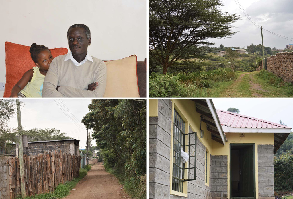
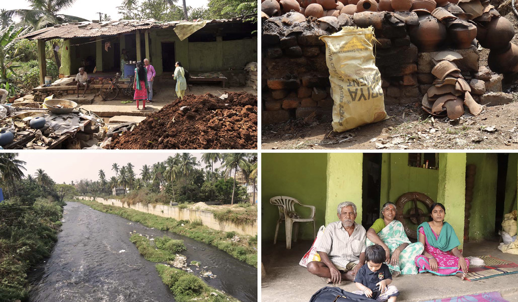
Sushila’s family has lived on the outskirts of Bengaluru, India, making and selling pottery, for more than 65 years. When her parents first moved into the Kengeri village, they found an abandoned kalyana mantapa (a space for marriage ceremonies) in the forest and set up their home there. Sushila, now 25 years old, has seen tremendous change across Bengaluru. Near her home, trees have given way to roads and shops. But infrastructure has lagged behind development. The built-up areas enveloping Sushila’s home have few city services.

For instance, access to water has improved only slightly. For about an hour a day, Sushila’s family can fetch water from a nearby bore well, which they use for bathing and washing clothes. They have to purchase the water for drinking and cooking. There is a bus stop about a five-minute walk from their home, but there are no designated footpaths, so the walk can prove dangerous. Solid waste management has not arrived, except that the city sometimes dumps waste into a nearby stream.

Sushila’s family’s combined monthly income is US$90 to $105, which is barely enough to pay for the maintenance and upkeep of their old, deteriorating house. Even though they have lived in their house for more than six decades, they do not have any legal documentation that says they own the property. This could soon be problematic as private developers continue to push outward from the center of the city. “Once an individual or real estate developer comes and builds something like houses and apartment complexes, the next one comes along, and the next . . . and there’s a lot of open land here to go,” says Sushila. She adds that there is no transparency about how land is sold to developers. She has heard of proposals for public projects such as extending the metro to Kengeri or widening Mysore State Highway, but neither she nor any anyone she knows in the community has been engaged in this planning.

Figure B13.1 | Sushila gathers with her family outside their Kengeri village home on the outskirts of Bengaluru

Picture credit: Radha Chanchani, 2016.

Note: These vignettes are based on in-depth interviews with urban residents conducted in seven countries grappling with the effects of urbanization (Brazil, China, Ghana, India, Kenya, Mexico, and Nigeria).

Low-density growth occurs on cheaper land in the urban periphery

New data gathered for Towards a More Equal City show how struggling and emerging cities with scant financial resources and severe deficits in built infrastructure are growing outward much more than upward. This accelerates the consumption of resources such as land, energy, and water and hampers the delivery of urban public services. As a city’s area expands and its population density declines, the per capita costs of public service provision rise, and so do social costs imposed by congestion, pollution, and urban inefficiencies.412

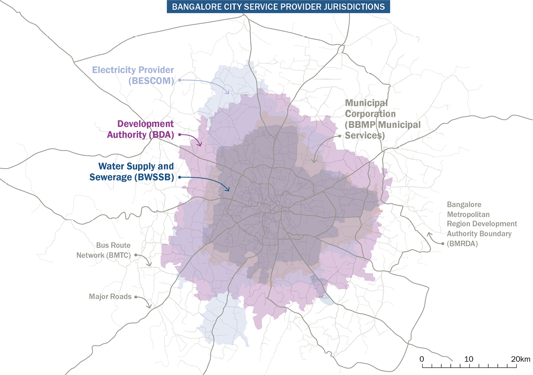
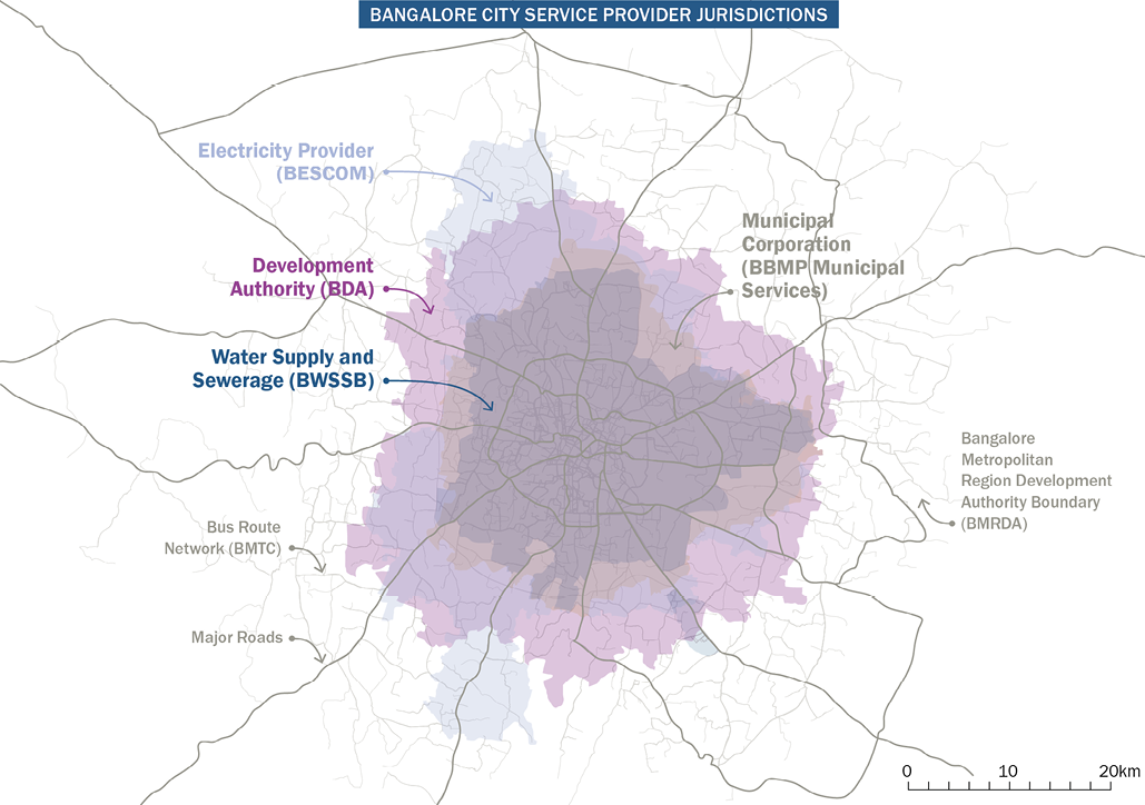
Our research identified a host of risk factors and policy choices that can accelerate outward, sprawling growth. High subsidies for fuel and low costs for private vehicles contribute by reducing the perceived costs of driving long distances.413 Restrictive density or building height regulations in well-serviced inner-city areas can push development outward.414 This outward growth typically occurs in areas on the urban periphery with unclear jurisdiction, involving multiple local (and sometimes regional, state, or rural) authorities that do not coordinate on service provision or land-use planning. As a result, it creates blind spots in some cases and confusion in others in the governance of burgeoning new settlements. Outside city limits, developers also find bargain land prices, lax record keeping, and fewer land-use regulations. This allows them to build many units on large land parcels, achieving economies of scale more easily and profitably than building in more central locations. Rapid, haphazard, unplanned sprawl then compounds the challenge and raises the cost of providing infrastructure and services. And limited control over peripheral areas makes it harder for cities to channel, or draw value from, land price surges and building frenzies.

Voices: Shlomo Angel on managing urban expansion


Perverse incentives add to these problems. Governments sometimes fuel building booms in the urban periphery by promoting investment in housing and special economic zones without regard for location and services. Social housing programs typically evaluate affordability in terms of income and housing costs alone, neglecting the high price of commuting or connecting housing with services. Thus, across Brazil, Chile, Ethiopia, India, Mexico, and South Africa, private developers have built in the urban periphery.415 Some governments, such as those of India and South Africa, are even building this type of housing themselves. Residents who move to these remote locations suffer because social networks that supported families and livelihoods get broken. They are saddled with long, expensive commutes that cut into their productivity and can eat up whatever they save in housing costs and choke cities with traffic congestion and air pollution. Evidence from African, Indian, and Latin American cities shows that access to multiple urban services, including paved roads, drainage, and good-quality piped water, drops sharply in peripheral areas.416 For these reasons, residents in a number of cities have abandoned some of these housing developments on the periphery altogether.417 A national housing program in Mexico reportedly cost $100 billion between 2001 and 2012 and built millions of homes in the distant outskirts of cities (e.g., 40 miles outside Mexico City). Today, a large proportion of these homes, which still lack running water and electricity and are not connected to public transport, sit abandoned.418

Weak spatial planning can result in mounting long-term costs

The long-term cumulative costs of low-density growth in peripheral areas typically dwarf what cities and households imagine they are saving.419

Weak spatial planning directly contributes to unmanaged urban expansion, which has far-reaching environmental consequences. Studies predict that, by 2030, global urban expansion will menace biodiversity hot spots and threaten ecosystems far beyond city limits. 420 Fast-growing cities envelop prime agricultural land and compete with food production. They also accelerate GHG emissions, air pollution, and urban heat effects.

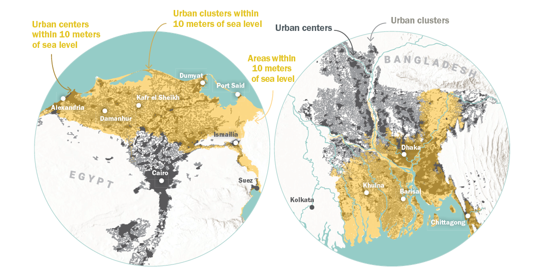
Urban sprawl exposes citizens to a variety of dangers that will undermine health and economic productivity. For example, some of the most rapid urban expansion is occurring in low-elevation coastal zones, which are vulnerable to floods, sea level rise, and other impacts of climate change. 421 Around the world, unabated and illegal construction on urban floodplains and water bodies in cities is already causing disastrous flooding.422 At the same time, the opposite problem of water scarcity is growing rapidly and creating disastrous ripple effects. Because 60 percent of new developments in cities in the global South are not connected to a central water system, many households rely on privately or self-provided bore wells. In Bengaluru, Jakarta, Mexico City, São Paulo, and elsewhere, indiscriminate, unregulated bore wells have rapidly depleted groundwater and caused the land to subside or sink.423 Clandestine connections to the municipal water supply are commonplace, leading to overextraction and water stress.

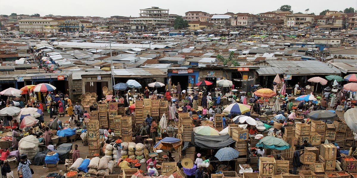
Weak spatial planning has had another consequence: a growth in informal, self-built settlements that are now home to over a billion people around the world. Some settlements, such as those in Kampala and Mumbai, are closer to city centers and jobs. But whether located centrally or in the periphery, what most have in common is what they lack: essential public services and infrastructure, including streets, water, sanitation, and electricity. Housing quality is poor, living spaces are overcrowded, and households, even families who have occupied the same spot for generations, often have no security of tenure. At any moment homes may be bulldozed and valued possessions destroyed. Someone may decide to locate a toxic waste dump next door.

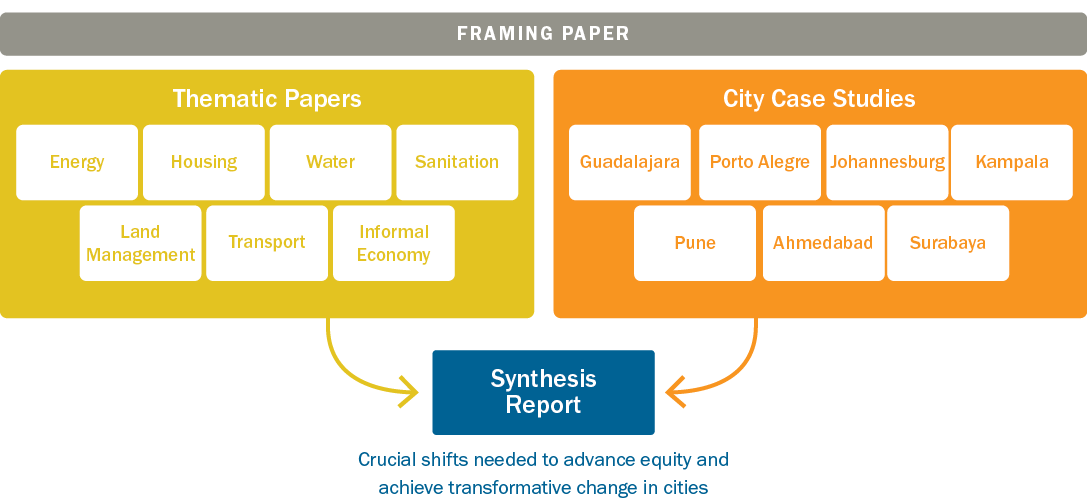
Towards a More Equal City presents new analysis of the links between accessibility (the relative locations of jobs and housing) and the time and money spent on mobility.424 
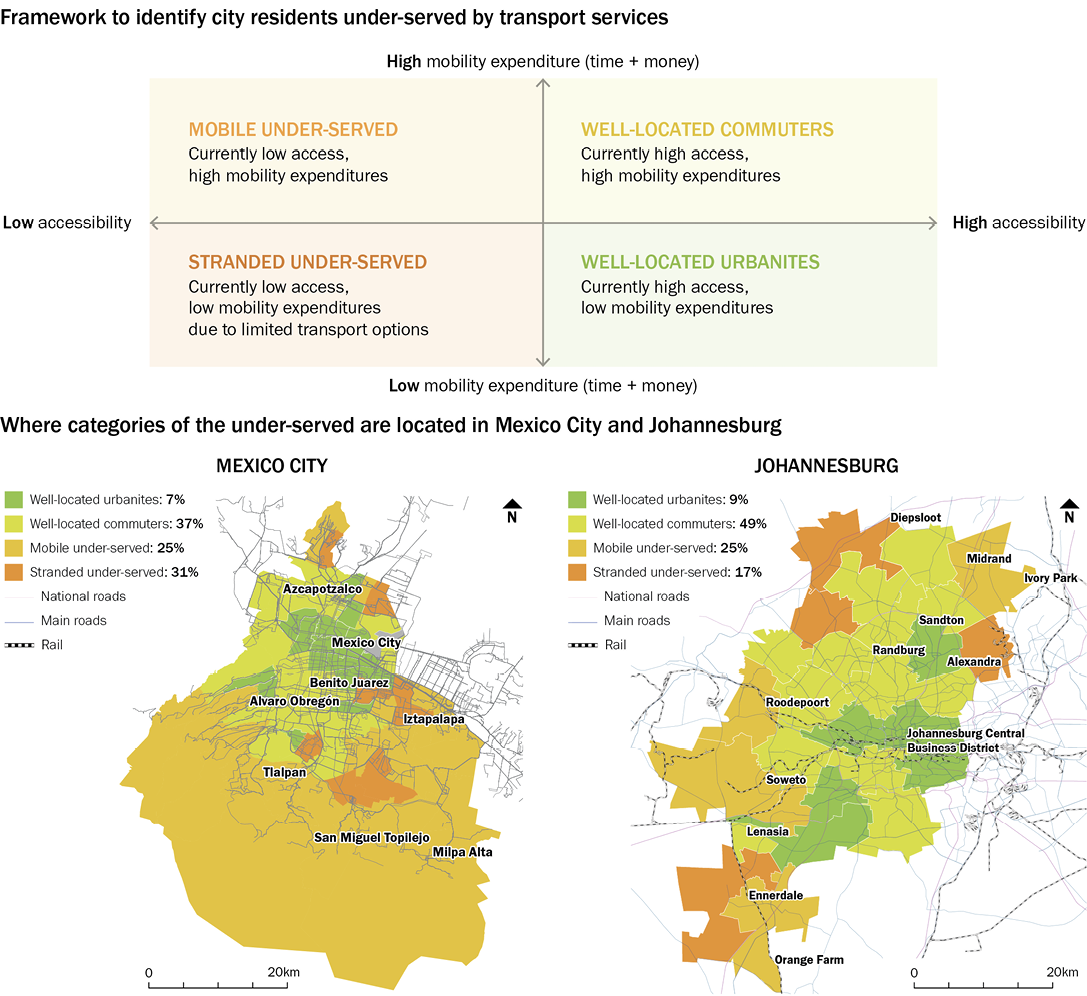
It shows that, in the global South, up to half of urban dwellers likely experience restricted access to jobs, leading to either high travel burdens or exclusion from opportunities. Figure 31 categorizes residents of Johannesburg and Mexico City according to their access to opportunities and their mobility expenditures. It illustrates a typical pattern: residents who are under-served by transport options tend to be located on the periphery of cities, which are far from most jobs.

One group categorized as the “stranded under-served,” face such severe access constraints that they travel little or not at all. This group includes many who can only commute on foot or by bicycle as well as those stuck in such poor locations that travel is completely unaffordable. Another group, the “mobile under-served,” do travel, often starting from peripheral suburbs far from economic opportunity. They spend a long time and up to 35 percent of their income on commuting.425 We also identified two other categories: “well-located commuters” and “well-located urbanites.” Well-located commuters are better off in terms of access to opportunities because they may own private vehicles, and well-located urbanites are located either close to jobs or in public transit corridors that provide easy access to the majority of jobs. In both cities, fewer than 1 in 10 people fall in this last category.

Overall, the majority of people in both cities—74 percent in Johannesburg and 62 percent in Mexico City—face higher-than-average costs in terms of both time and money to reach their destinations.426 This analysis is backed up by other evidence. A study of social housing residents living in peripheral areas of secondary cities in Brazil, Colombia, and Mexico found that households pay on average about 40 percent less than they would for a centrally located unit in a low-income area, but their commutes cost twice as much and take three times as long as they do for centrally located households.427 This poor accessibility directly affects people’s productivity and, ultimately, their earnings.

Figure 31 | New analysis shows spatial inequities in access to jobs and mobility expenditures in Mexico City and Johannesburg

Notes: Accessibility is the number of opportunities reachable within 60 minutes; mobility expenditure is the actual amount of time and money spent traveling. This analysis allows decision-makers to consider strategies that increase accessibility while keeping mobility expenditures low by understanding the needs in different locations of a city. It allows them to integrate land-use and transport considerations in their decision-making.

Source: Venter et al., 2019.


11.2 Priority Actions

A. Structure regulations and incentives to make land markets more transparent and inclusive

Cities can use an array of policies and fiscal instruments to make land markets more inclusive, efficient, and responsive to the needs of the public.428 They can establish incentives to direct development towards specific locations within cities, impose time limits on how long land can be held without being built upon, tax vacant land and buildings, and implement land value policies that benefit both private land developers and the city. Planning focused on spatial equity can stop urban development and real estate investment from exacerbating existing patterns of inequality, segregation, and isolation. Regulations can guarantee that adequate urban infrastructure is provided wherever new development and urban regeneration occur. This helps avoids the economic, social, and environmental costs that result from unmanaged expansion and self-provision of services.429

Regulations and incentives to enable affordable housing in accessible locations

Regulations can enable land development and the construction of affordable housing in well-serviced locations as well as require private developers to contribute to infrastructure costs. These steps can achieve more equitable outcomes and allow all residents, regardless of their location in the city, to access urban services and opportunities. For example, after Brazil and Mexico made the mistake of building now-abandoned affordable housing in the urban periphery, they changed course. They began providing national housing subsidies to developers to build affordable housing in designated zones based on regularly updated spatial and socioeconomic data on access to core services and employment.430 In 2013, 80 percent of housing in Mexico was built in these identified zones, which are called Urban Containment Perimeters (Perímetro de Contención Urbana), and the subsidies were significantly reduced after 2018.431 In other locations, developers are required to fund and build infrastructure to extend core services (water, sewer networks, electricity) and sidewalks to their developments, and municipalities are responsible for operating the services.432 In 2003, South Africa passed a law offering tax incentives to developers to build, extend, or improve buildings in specific urban development zones (UDZs).433 In Johannesburg, the city with the largest UDZ, a comprehensive, publicly available property database was developed in partnership with property owners, which has enabled the design of incentives for developers to build in the city’s new BRT corridors.434

Facilitating supply of well-connected land and housing to reduce scarcity

Cities can also impose time limits on landholding and tax vacant land and buildings to prevent land hoarding or high vacancy rates. Land and housing units are often held back from the market in the hope of higher returns later.435 This creates shortages in supply of land and pushes up prices. China and several Latin American countries tax vacant land to reduce speculation, induce development, and bring vacant units into the rental market. As a strategy to limit speculation and discourage land hoarding, some countries, such as Colombia, Malaysia, and Sri Lanka, temporarily freeze land values in locations where major urban development schemes have been announced. 436 City governments need the statutory authority, resources, and capacity from higher levels of government (national and state) as well as trained staff to devise and enforce development plans and regulations of this kind.

Raising public revenues from urban land

There is a compelling case for cities to implement land value capture mechanisms, which include property taxes, charges for building rights, and development impact fees. 437 Using these mechanisms, cities can raise funds to create a virtuous circle: investing in infrastructure to foster economic development and rising land values, which, in turn, create demand for more infrastructure. In many cities of the global South, weak institutions and land governance structures—and subversion by political or private development interests—can stymie such schemes.438 But a large and growing number of cities around the world are using them. Even simple forms of land value capture, such as property taxes or special development charges, can generate much-needed local revenue to finance infrastructure and services.439 In Bogotá, for example, a betterment levy (contribución de valorización) charges property owners a fee to defray the costs of public works improvements. From 1997 through 2007, this mechanism financed over $1 billion worth of investment in 217 public road and infrastructure projects all over the city.440 Such land value capture instruments have also been used to finance transport-related improvements in Bogotá, Brasilia, Hong Kong, Hyderabad, Mumbai, and São Paulo.441 These instruments have succeeded by jointly managing the development and sale of land with the construction of transport infrastructure. They show how critical it is for cities to coordinate across agencies and adopt an integrated approach to land development and transport improvements. More examples of land value capture tools can be found in Transformation 5 on transforming financial investment to prioritize and subsidize urban services for vulnerable groups.

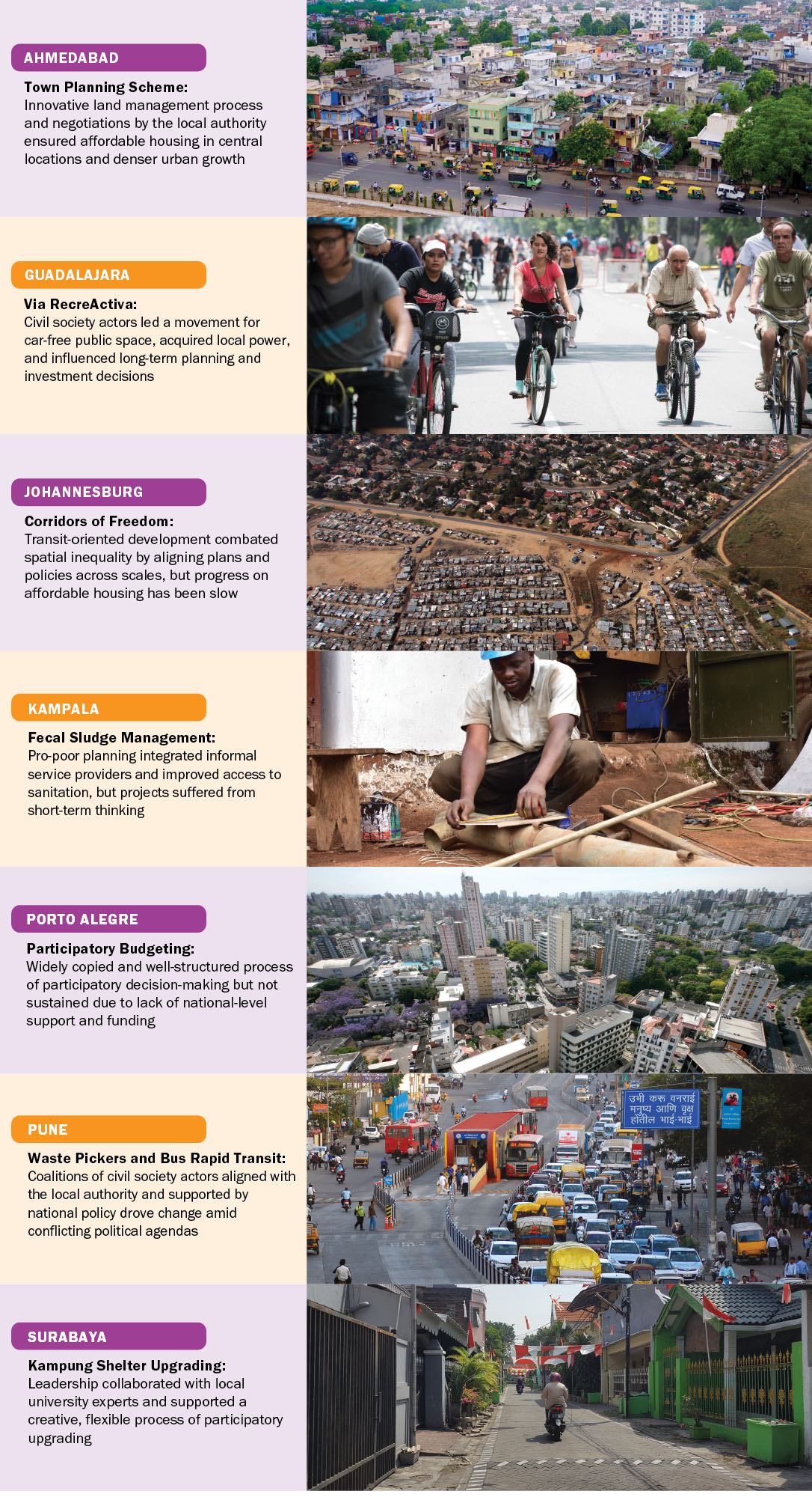
Box 14 illustrates how a change in land-use laws allowed Ahmedabad to use a mechanism known as the Town Planning Scheme (TPS) to manage the growth of the city. It also shows the application of land value capture policies, which are one way to combine land regulations and incentives while creating additional revenues to finance infrastructure.

Box 14 | Ahmedabad uses the mechanism of Town Planning Scheme for sustainable expansion

The Towards a More Equal City case study of Ahmedabad, India, showed the Town Planning Scheme (TPS) has been transformational in allowing the city to increase the supply of well-connected land in planned locations and sustainably manage its urban expansion. The TPS involves negotiations between the city, private developers, and landowners. Instead of just taking land for public services through eminent domain, Ahmedabad readjusts the boundaries of private plots, making space for roads and sewer and power lines and other infrastructure. Landowners get compensated for land taken, minus a portion of the cost of providing the infrastructure. Therefore, the city and landowners share the costs and benefits. The TPS faced challenges in Ahmedabad. It was difficult to engage tenants, raise financing, and win cooperation from farmers in locations slated for new growth. But it has reduced commuting distances, increased street density, and prompted the construction of affordable housing in close-in, accessible neighborhoods.

Figure B14.1 | Land is planned and serviced through an area development approach

Figure Source: Mathews et al., 2018.

Implementing the TPS in Ahmedabad required changes in state law that allowed the city to do so. The state of Gujarat passed an amendment under the Town Planning and Urban Development Act that encouraged coordination across sectoral agencies to deliver urban services in tandem with the city’s development plan, with infrastructure financing generated from land sales. In addition, national-level financing programs for housing for the urban poor supported the construction of affordable housing within the TPS. These national- and state-level actions enabled the city to utilize the TPS to guide urban development.

Source: Mahadevia et al., 2018.

B. Improve services in informal settlements to achieve affordable, livable density

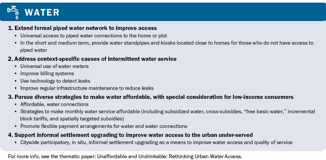
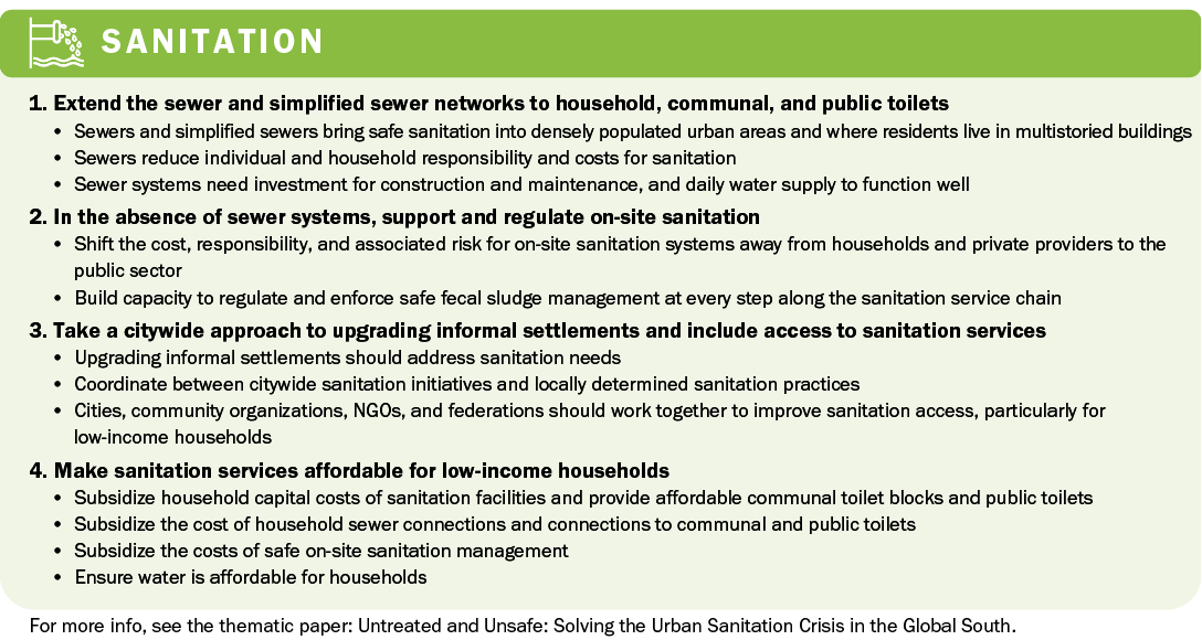
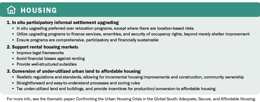
Transformation 1 includes many examples of successful approaches to making housing more affordable and livable.442 Here, in discussing interventions specifically related to land and spatial planning, we focus on how cities can extend core services to already very dense informal settlements and create affordable, livable density through flexible planning standards.

Affordable, livable density means a level of housing density that allows a good quality of life and well-being for all, especially the more vulnerable, without placing an undue burden on household finances (see Box 15). It means no overcrowding in living spaces, good access to core services, and a human scale that achieves a balance between mid- to high-rise buildings, open public spaces, and street connectivity. In line with SDG indicators, affordable would mean no more than 30 percent of a household’s monthly income spent on housing and transport combined.443

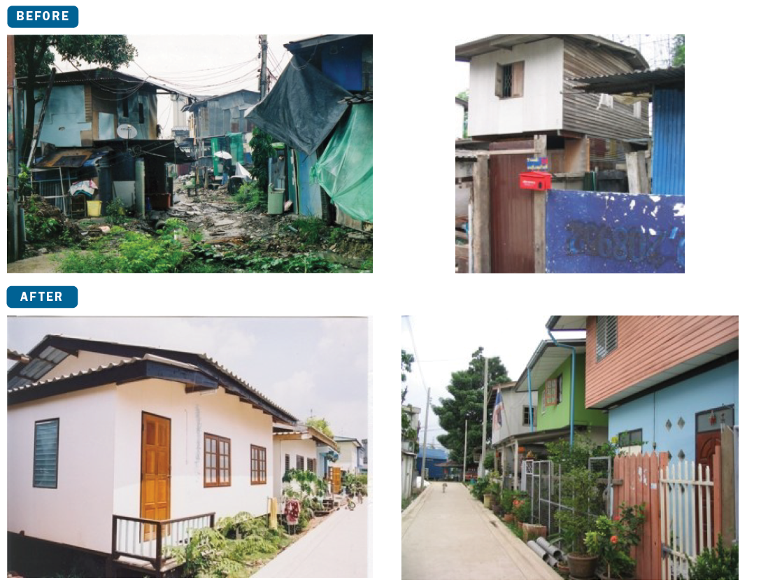
Cities have a long track record of displacing residents, sometimes involuntarily, to “affordable” housing in the urban periphery. We argue that affordable, connected housing can often be better provided by upgrading informal settlements in place if they exist in otherwise secure locations, minimizing vulnerability to climate risks. In Medellín, the public sector utility company Empresas Públicas de Medellín, which provides electricity, gas, water, sanitation, and telecommunications services, has for decades run a program called Fitting-Out of Dwellings (Habilitación de Viviendas) to extend services to people living in the city’s growing informal settlements.444 Similarly, in the Social Urbanizers project in Porto Alegre, municipalities engaged with private sector informal developers to ensure set minimum levels of service provision and better-planned informal subdivisions. This experience has been replicated in Colombia and El Salvador.445 Regularization programs for informal settlements in Rio de Janeiro and other Brazilian cities have provided legal titles and upgraded services at the same time.446

With or without formal regularization programs, improving services and livability in very dense informal settlements requires that cities adopt flexible minimum planning standards. Inclusionary zoning, such as the Zones of Special Social Interest (Zonas Especiais de Interesse Social) used in Brazilian cities, allows less restrictive densities and building standards and features lower transaction costs for building approvals. It allows rezoning of informal settlements, or favelas, so that they can be legalized and connected to city services. Existing informal settlements—such as Khuda-ki-Basti 3 in Karachi, La Candelaria in Medellín, and several in Windhoek—utilized smaller plot sizes and lower infrastructure standards to increase affordability while upgrading informal settlements, with the ability to densify even more over time. 447 This has increased the number of services reaching under-served areas in the city without displacing residents. Sites-and-services projects in the Indian cities of Mumbai and Chennai used similar principles to allow for incremental development while allocating space for commercial and social services and facilitating high density through a hierarchy of streets and open spaces.448

Tenure insecurity in informal settlements makes implementing such actions difficult. With significant proportions of urban residents living under insecure land titles and tenure, some cities are paying more attention to existing community-recognized titles and tenure systems.449 Particularly in Africa, overlapping public, private, tribal, and customary landownership rules create challenges as tribal and customary ownership is often deemed “informal.” But increasingly countries such as Botswana, Namibia, Rwanda, and Zambia are recognizing customary landownership as part of formal land tenure systems and regularization programs.450

Box 15: Density and its effects must be better understood

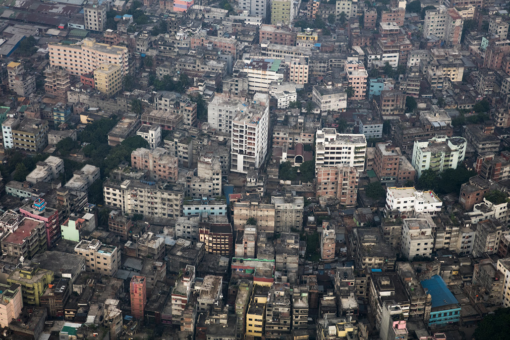
Although density offers many advantages, including efficient delivery of public services and accessibility, it has been a contentious topic, often leading to misinformed policy prescriptions and unintended consequences. On the one hand, highly restrictive regulations that limit densities in growing cities are partially responsible for driving urban sprawl; on the other hand, high-end, high-density development is often accompanied by unaffordability, gentrification, and displacement. a Further, recommendations to densify rely too much on a single operational measure: population density. They may neglect important aspects of the built environment, such as the quality and design of structures, whether buildings are tall and close together or have open space between them, and whether they are already overcrowded.b On paper, an urban area may not appear to be dense; yet, in reality, each house may be packed with people. For example, the Democratic Republic of the Congo’s capital, Kinshasa, has a lower population density than Dhaka, Bangladesh, or Hong Kong, even though it has almost double the floor-space occupancy (or crowding) of Dhaka and almost four times that of Hong Kong.c This highlights the problem with overly simplistic recommendations to “densify.” In a low-income city where affordable housing and urban infrastructure are in short supply, building tall, high-end apartment buildings with lots of floor space per capita actually exacerbates spatial inequalities, even if it increases density. To accommodate growing populations, to provide a humane, healthy environment where they can thrive, be productive, and contribute to the civic and economic life of the city, cities must prioritize affordable, livable density.

Figure B15.1 | Very high levels of density in the city of Dhaka

Picture credit: Dominic Chavez, World Bank

Sources: a. Economist, 2015; Bertaud and Brueckner, 2005; Brueckner and Sridhar, 2012; Rode et al., 2014; Ahlfedlt, G., and E. Pietrostefani, 2017.; b. Angel, 2019; Neuman, 2005.; c. Angel, 2019.

C. Practice integrated spatial planning for better urban services and sustainable growth

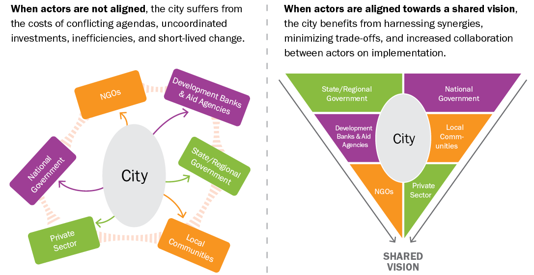
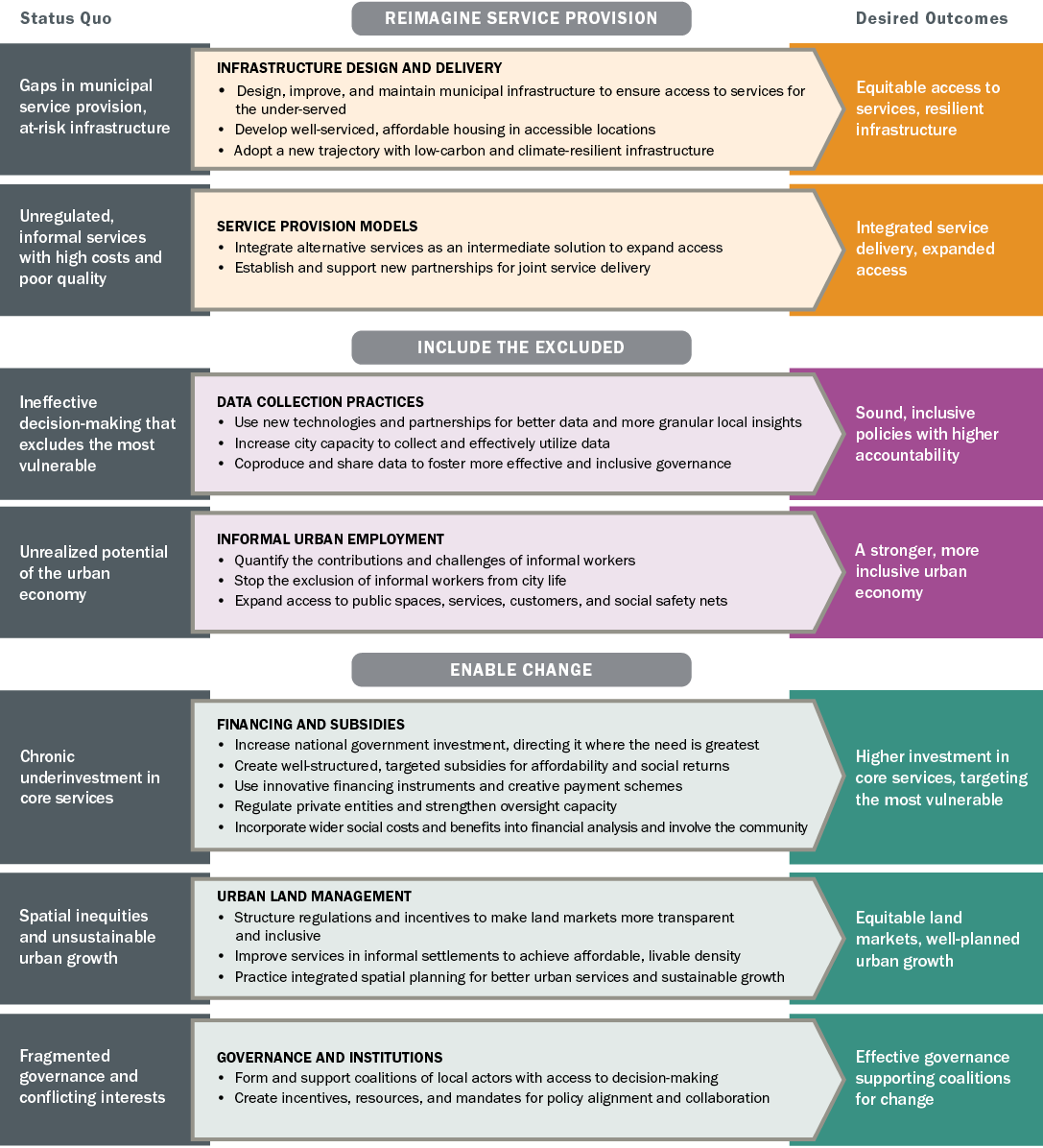
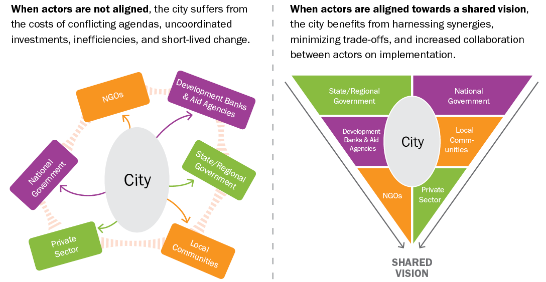
Cities must develop density and land-use policies—aligned across spatial scales from metropolitan to regional to local—to guide citywide growth and development of neighborhoods.451 We created the first publicly available global data set of upward and outward growth over time in almost 500 cities, showing most cities expanding in both dimensions, with the dominant type of growth varying across parts of a city.452 These growth patterns were also analyzed by type of city, showing that struggling cities have negligible upward growth relative to other cities in the sample. It is clear from the data that a two-pronged approach is needed when considering where to expand the supply of serviced land. In vacant, under-utilized, or low-density areas within cities, municipal governments can encourage more upward and compact growth near employment centers and services, such as along public transit corridors. In cities that are growing upward to accommodate more people and expanding rapidly outward as well (e.g., Chinese cities), trade-offs need to be made. These rapidly growing cities must increase the supply of serviced land, working in partnership with private developers and landowners to balance the cost of land with the cost of connecting it with services. Spatial and economic development must be integrated so that land and infrastructure plans guide the development of new housing and employment centers. This also ensures a more even distribution of jobs and residential densities. Investing in reliable public transport to support these plans saves people the time and money they must spend on getting around and can further improve productivity and livelihoods, preserve social networks, and protect the environment.

Cities should densify strategically so that they consume land more efficiently. There are four ways they can do this:

  • Using under-utilized or vacant land within the city because it is already connected to services
  • Upgrading informal settlements within the city to good-quality and well-serviced affordable housing
  • Targeting well-located, well-serviced land within the city to densify—that is, increasing affordable housing with medium building heights while enhancing services453
  • Planning for new affordable housing in the immediate periphery as needed while ensuring that trunk infrastructure is extended to these developments as they are planned

Further, crafting flexible standards for living space and services for different income groups and their lifestyles can make housing more affordable. Households can add building height and additional rooms as their incomes increase, provided the trunk infrastructure can support the higher density. This strategy has been used in Chennai, Mumbai, and Windhoek. Features such as smaller lot sizes, narrower streets, and more community open spaces instead of private ones have allowed density to increase and have opened up more access to housing for lower-income groups, but in a way that improves quality of life and livelihoods (see Figure 32). Table 7 lists the actions and roles required of different actors to move Transformation 6 forward.

Source: Authors.

Table 7 | Roles of specific actors in advancing Transformation 6: Urban Land Management

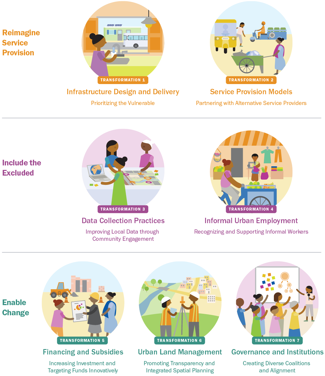
Urban Land Management—Promoting Transparency and Integrated Spatial Planning

City Government and Urban Sector Specialists

  • Use fiscal instruments to help make land markets more inclusive and productive and to capture land value to invest in public infrastructure
  • Develop regulations and incentives to limit land value speculation, encourage transparent land records, and promote well-located affordable housing
  • Understand changes in built form and accessibility needs to inform policies on density and local land-use regulations; consider indicators of density, crowdedness, and access together to prevent misinformed policies and unintended consequences
  • Practice integrated planning of land and infrastructure to address spatial inequities in line with local economic development, low-carbon development, and climate-resilient plans
  • Utilize vacant land and develop denser mixed-use neighborhoods within the city while enhancing the infrastructure and services needed to support higher density
  • Plan for urban expansion with space allocated for core infrastructure and services while protecting vital ecological areas (e.g., green spaces as flooding buffers, wetlands, biodiversity zones) and ensuring new housing and employment centers are accessible by public transit to reduce emissions
  • Upgrade informal settlements in secure locations into affordable housing that meets residents’ needs and improves living conditions instead of displacing them to housing in the urban periphery
  • Design and implement flexible planning standards to make good-quality housing with services available for a range of income groups
  • Incorporate information on climate risks in planning urban infrastructure and services; build the climate resilience of the most vulnerable populations
  • Engage community actors in urban development planning to fully understand the needs of the most vulnerable communities

National Government

  • Establish complete and transparent nationwide urban land records of ownership, values, and transactions, at least in urban areas where land is highly contested and subject to speculation
  • Ensure planning for affordable housing programs accounts for land costs, service provision costs, access to core infrastructure, and connectivity to employment
  • Authorize local and state governments to collect land-based revenues and taxes
  • Create land acquisition laws and land management regulations that fairly compensate original land owners, with provisions for landless workers and tenants
  • Incentivize integrated spatial planning in urban areas that incorporates climate change mitigation and adaptation actions in regional and urban development plans
  • Establish planning processes and mandates for inclusive urban planning that engage vulnerable groups and the broader community

Civil Society, including Nongovernmental Organizations, Experts, and Researchers

  • Engage in and help design participatory processes to provide input on local development plans; organize communities when these plans are detrimental to community concerns
  • Provide data and analysis to ensure local officials understand the short- and long-term socioeconomic, environmental, and equity impacts of land regulations and spatial plans, including climate risks
  • Advocate for and develop tools to support local officials in completing land records and making land transactions more transparent
  • Act as watchdog to monitor when development flouts approved plans and regulations or creates social and environmental risks
  • Advocate for embedding equity criteria in local development plans, land-use regulations, and housing policies
  • Inform and educate vulnerable groups so they can participate in planning processes, and push local officials to include them

Private Sector

  • Invest in land and property development within the framework of local land-use and regional plans and regulations
  • Contribute to transparent land records and support public authorities to develop a database of land ownership, values, and transactions to limit speculative prices increases
  • Partner with local land and regional land development authorities to increase supply and financing of well-serviced, well-connected land for affordable housing and other public infrastructure

International Community, including Development Finance Institutions

  • Support cities with knowledge and tools to develop better and more transparent land records that enable property tax collection, more inclusive land markets, and limit land value speculations
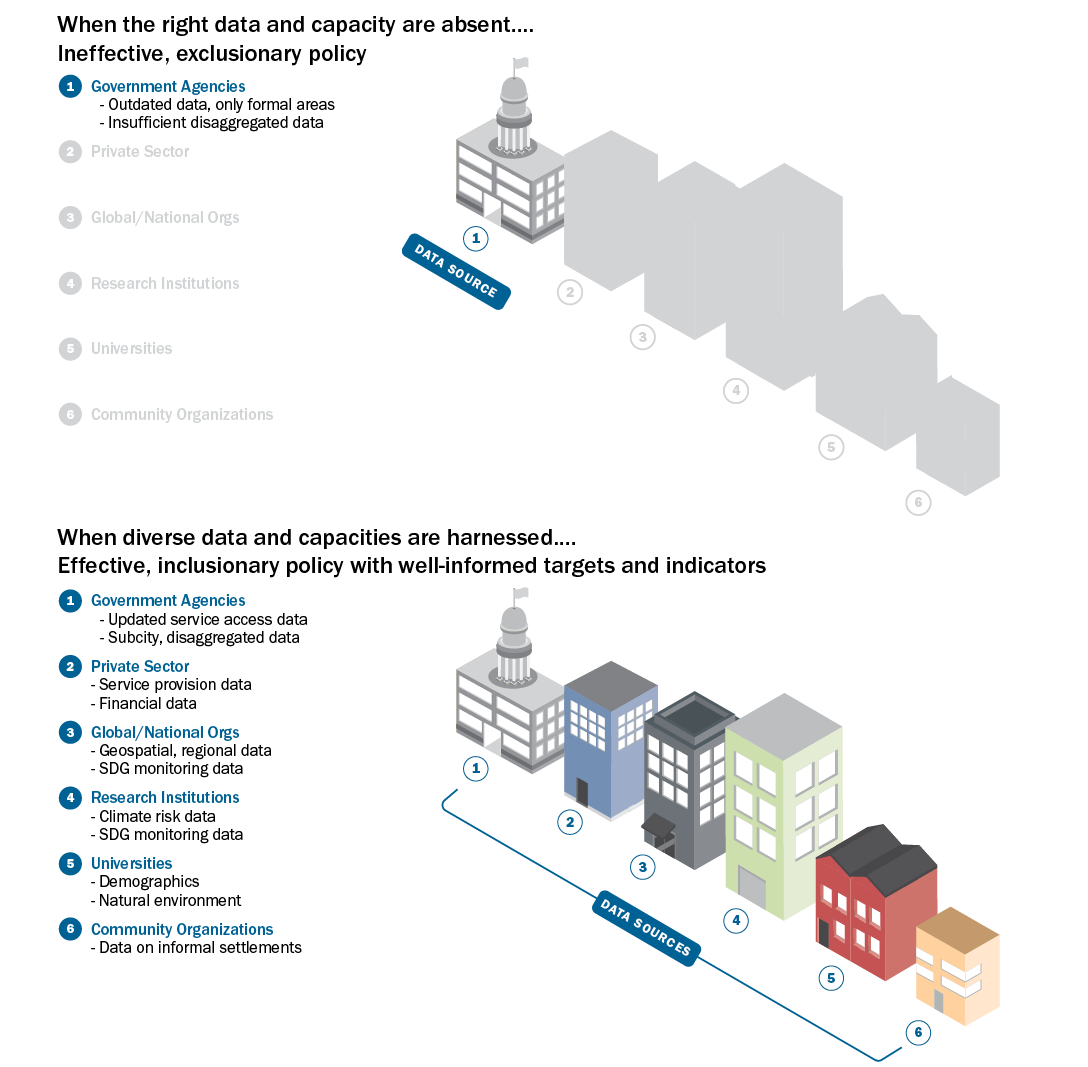
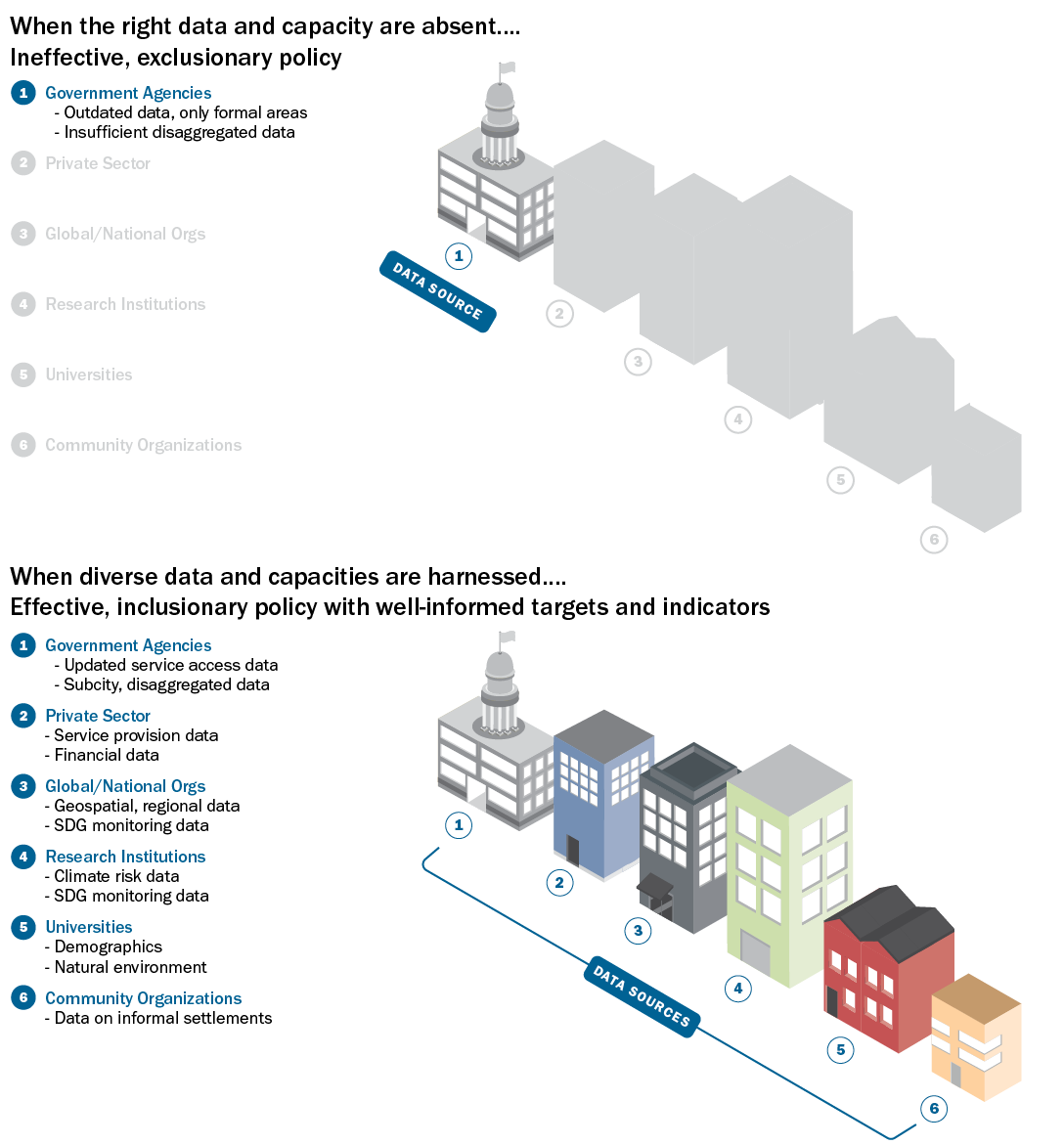
  • Incentivize data transparency and mandates to share disaggregated and spatial data across jurisdictions and stakeholder groups in urban areas
  • Use peer exchange and knowledge networks to share international good practices on land-use regulations, integrated spatial planning, climate action planning, slum upgrading, and other mechanisms to ensure equitable access to urban services and a more sustainable city
  • Share lessons on national, regional, and local land-use regulations and building approval processes to limit exploitative practices in land acquisition, reduce speculation, and limit the increase of informality

Source: Authors.

Start reading